Ohio maps: printable and free
5 free maps of Ohio: high-resolution PNG (300 dpi) and PDF for US Letter or A4.
PDF = US Letter; A4 for other countries. Tap a map to view it full size. Free for personal, school and commercial use.
Data updated · By Ankit Kumar, compiled from public U.S. government and open datasets · How these numbers are made
1. Ohio blank outline map
The state border only, with a scale bar. Good for labeling, coloring and tracing.
 View full size
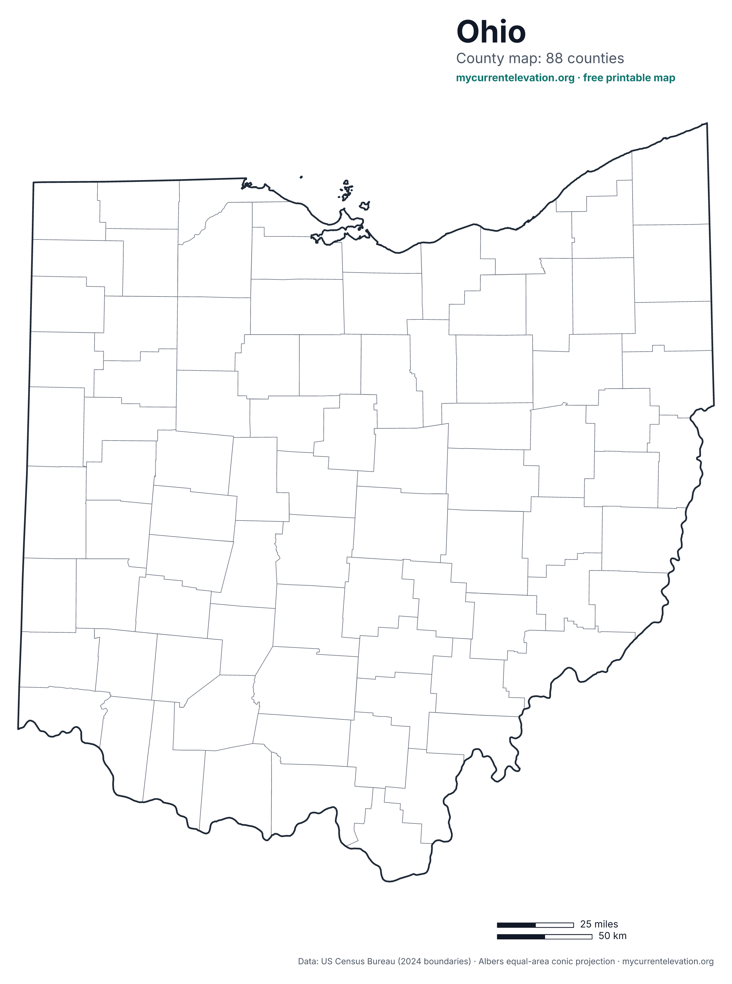
2. Ohio county map
All 88 counties, outlined without names.
 View full size
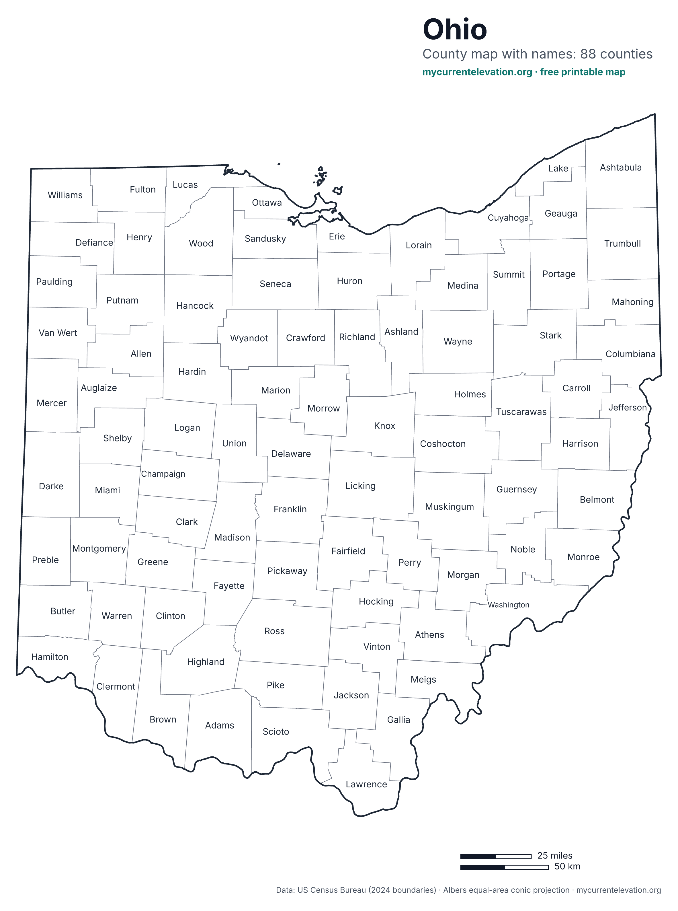
3. Ohio labeled county map
The same 88 counties, each named. Names that don't fit inside a small area sit just outside, joined by a short line.
 View full size
4. Ohio map with major cities
23 cities, chosen by 2024 Census population and spaced so no labels overlap. The capital is marked with a star.
 View full size
5. Ohio elevation map
USGS 3DEP elevation as color plus hillshade. Legend in feet with meters underneath; triangles mark the high and low points, a star the capital.
 View full size
Ohio: shape, counties and terrain
Ohio spans about 227 miles from east to west and 247 miles from north to south, with 40,859 square miles of land. Its outline is fairly compact: the state fills 73% of the box drawn around it on the map. The Census boundary file draws it as 16 separate land areas, only one of them larger than 100 square miles.
Ohio has 88 counties. The largest by land area is Ashtabula County (702 sq mi) and the smallest is Lake County (229 sq mi). The capital, Columbus, sits at 780 ft downtown (USGS).
Elevation runs from 455 ft (139 m) on the Ohio River to 1,550 ft (472 m) at Campbell Hill in Logan County, a range of 1,095 ft. The sampled average is about 923 ft.
On the relief map's elevation grid, under 1% of the state lies below 500 ft, 72% between 500 and 1,000 ft and 28% between 1,000 and 1,500 ft and under 1% above 1,500 ft. Split from south to north into thirds, the southern third averages 819 ft, the central third 989 ft and the northern third 775 ft, so the land is highest in the central third and lowest in the northern third.
More figures, with sources: Ohio elevation: highest, lowest and average points.
How teachers and students can use these maps
- Blank map: label Columbus, the capital, and the largest cities, then check them against the cities map. Older students can draw in rivers or mountain ranges from an atlas.
- County map: find your own county among the 88. The labeled version works as an answer key; the blank one as a quiz.
- Cities map: Columbus to Mentor is about 148 miles in a straight line. Measure it with the scale bar and see how close you get.
- Elevation map: find Campbell Hill (1,550 ft) and the Ohio River (455 ft), and work out the difference: 1,095 ft. Then use the legend to estimate the elevation of your town and check it with our elevation tool.
- Printing: each map has a US Letter PDF and an A4 PDF. The PDFs are vector files, so lines and labels stay sharp at any size. The outline maps use very little ink in black and white.
License: free to use
These maps are free for personal, school and commercial use. Print them, copy them, change them, and use them in worksheets, slides, books, apps or websites. No permission or fee is needed. A credit is appreciated: Map: MyCurrentElevation.org.
The data behind them (US Census Bureau boundaries and population, USGS elevation) is in the public domain. Inter, the typeface on the maps, is licensed under the SIL Open Font License.
Sources
- U.S. Census Bureau, 2024 Cartographic Boundary Files (states, counties; 1:500,000) — state and county borders, county land areas, map extents
- USGS 3D Elevation Program (3DEP) elevation service — elevation colors and shading on the relief map, and the elevation shares quoted above
- U.S. Census Bureau, Vintage 2024 Population Estimates (cities and towns) — which cities are largest
- U.S. Census Bureau, 2024 Gazetteer Files (place locations) — city locations
- USGS, Elevations and Distances in the United States (highest and lowest elevations) — Campbell Hill elevation (highest point)
- USGS, Elevations and Distances in the United States (highest and lowest elevations) — lowest point
- USGS 3DEP via the Elevation Point Query Service — sampled average elevation and the capital's downtown elevation
- U.S. Census Bureau TIGERweb, Counties layer — number and type of county-level areas
How each number is produced: methodology and data sources.
Other states and the US map: all printable maps · Ohio elevation
Data updated · By Ankit Kumar, compiled from public U.S. government and open datasets · How these numbers are made