Angle of Elevation >
Degrees: 0°
Radians: 0 rad
How to use Angle of Elevation Calculator
You can easily use our Angle of Elevation tool. You are required to provide two values - Vertical Distance (Rise) and Horizontal Distance (Run), and that's it. Our tool will find out the gradient angle for you in radians and degrees.
Follow the steps below for more details -
- Step 1: Select the units for distance. First, you need to select the unit in which you will input the values of rise and run. As you will see, 'Miles' is selected by default. You can change it to - Kilometers, meters, and feet. The best part is that you can choose different units for rise and run.
- Step 2: Enter the Rise value, that is, the Vertical Distance.
- Step 3: Enter the Run value, that is, the Horizontal Distance.
- Step 4: Click on ‘Calculate’ button
What does Angle of Elevation Calculator do?
We have several tools on MyCurrentElevation.org to help you in your household and professional life. The Angle of Elevation calculator is one of the tools that helps you find the gradient angle of a terrain formed by a line of sight above the horizontal.
To find the angle of elevation of a terrain, you just need the horizontal and vertical components, and by using the basic principle of trigonometry, you can easily find the angle of elevation. Our tool does all the mathematical calculations for you. So, you don't have to waste your time doing the basic maths.
Our tool can be used to input values in several units of measurement, and you get the results in radians and degrees.
Here's what the Angle of Elevation Calculator does for you:
- Facilitates Easy Calculations
- Supports Multiple Units of Measurement
- Displays Dual Outputs
- Enhances Learning
- Aids in Planning and Design
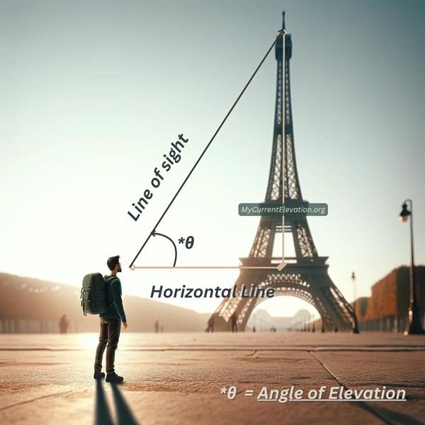
What is Angle of Elevation or Elevation grade?
The angle of elevation or the elevation grade is nothing but the angle between the horizontal plane and the line of sight. As you can tell, the line of sight is an imaginary line drawn from the point of observation to the object.
Imagine if you are looking at the top of the tower. Here, the line of sight will be drawn between your eyes and part of the tower you are looking at. The angle made by the line of sight with the ground is the angle of elevation. It's a concept often encountered in trigonometry, surveying, and engineering.
Why is it required to calculate Angle of Elevation?
1. Surveying and Landscape Planning
Before the construction project kicks off, the surveyors are required to find the gradient of the terrain. And as you already know, terrains are not always perfectly flat. So, one needs to find out the angle of elevation to find out the gradient of the terrain to understand the flatness of the terrain in its entirety. After all, you don't want your construction site to be a water pool site.
2. Infrastructure Development
Other than surveying the terrain, the angle of elevation is also used in creating infrastructure such as bridges and overpasses. It is also important to find the angle of elevation at which the road or bridge is built that supports the expected load.
3. Structural Integrity
How external forces like the wind will affect a structure like a roof with a slope depends on the angle of elevation of the roof. A correct elevation or slope angle can help the roof withstand even strong winds.
4. Design and Architecture
The angle of elevation also affects the ergonomics and accessibility of structures like stairs, ramps, or roofs. Thus, calculating the angle of elevation is essential when determining the line of sight for various structural elements.