What is my Current Elevation/Altitude?
What Is This Tool About?
We have designed this tool, known as My Current Elevation (accessible at MyCurrentElevation.org) to let you know what is your elevation or altitude at your current location.
This tool relies on advanced geolocation technology, Google Maps, and other resources to provide you real-time elevation data by just accessing your current location using your browser.
Designed for ease and accuracy, this tool can be used for free to know your current elevation. So, whether you’re scaling a mountain, navigating new terrains on a hike, or engaging in educational projects, MyCurrentElevation.org is your go-to resource for finding your elevation.
How to use this tool
Step 1: Click on the ‘Find My Elevation’ button.
Step 2: Allow location access when prompted by your browser.
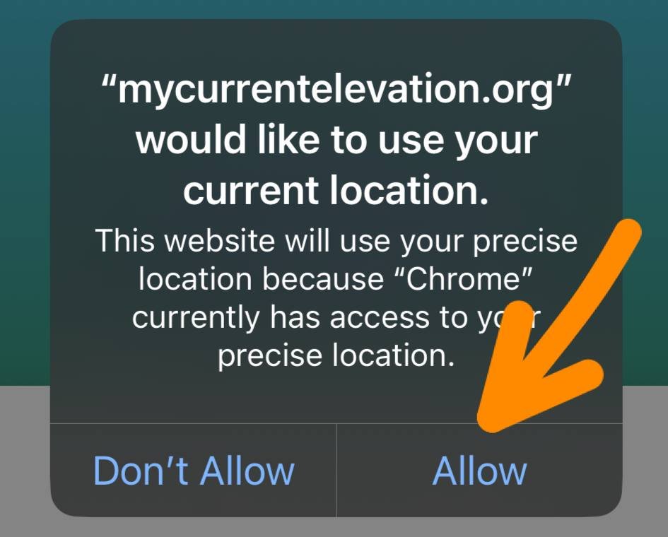
Step 3: View your current elevation, displayed in both meters and feet.
What Is Elevation?
Elevation can be defined as the vertical distance between a point or object above a fixed reference point, generally sea level.
In other words, you can say that elevation is the measurement of how high a point is from the sea level on the surface of the earth and not in the air.
When the distance is measured from a point in the air from the sea level such as the height of a flying airplane from the sea level, it is known as altitude.
Well, the elevation of a point can also be below the sea level or the fixed reference point. This type of elevation is known as depth.


How Is Elevation Calculated?
Traditionally, the elevation was calculated using a device known as an Altimeter. This device calculates the elevation using barometric pressure readings, where lower pressure indicates higher elevation.
In the modern world, the elevation is calculated using advanced techniques such as satellite-based systems like GPS. These systems are more accurate, fast, and reliable as these tools determine elevation by triangulating signals from satellites to determine the location and altitude.
Well, most smartphones today have a barometer sensor to help you determine your elevations or count the number of steps you climb.
Fascinating Elevation Tidbits
Elevation plays a major role in human settlement, below are three facts how elevation affects us:
- Agricultural Adaptation: The famous coffee belt, known for its premium coffee bean production, is located at optimal elevations between 1,200 and 1,800 meters above sea level. These elevations offer the perfect balance of cooler temperatures and abundant rainfall, fostering the rich flavors of the coffee beans.
- Climate Influence: Elevation can dramatically alter climate conditions within short distances. For instance, higher elevations typically foster cooler temperatures, leading to diverse climate zones on a single mountainside.
- Olympic Feat: Did you know? The city of La Paz in Bolivia is so high (around 3,650 meters or 11,975 feet above sea level) that when it hosted the 1977 Bolivarian Games, numerous records were shattered due to the thin air aiding athletes’ performance!


Highs And Lows Of Our Planet
- Highest Point on Earth: Mount Everest is the Earth’s highest mountain above sea level, reaches a breathtaking elevation of 8,848.86 meters (29,031.7 feet). It is located in the Mahalangur Himal sub-range of the Himalayas.
- Lowest Point on Earth: The lowest point on the earth is Challenger Deep in the Mariana Trench having the depth approximately 10,984 meters (36,037 feet). It is located in the western Pacific Ocean at the southern end of the Mariana Trench, in the ocean territory of the Federated States of Micronesia.
Elevation vs Altitude
Elevation
Elevation refers to the height of a point on the Earth’s surface above sea level. It is a static measurement that does not change, barring any major geological events. Elevation is commonly used in mapping and construction, and it is a critical factor in planning infrastructure like roads, buildings, and bridges. For example, the elevation of a mountain is the distance from sea level to its peak.
Altitude
Altitude, on the other hand, is the height of an object or point in relation to the Earth’s surface or sea level (usually high in the air). It is a more dynamic measurement and is commonly associated with the height of an aircraft or satellite in flight, or a climber ascending a mountain. Altitude can change based on the object’s position and is often used in aviation, space exploration, and activities involving height above ground level.
Key Differences
- Reference Point: Elevation is always measured from sea level. Altitude can be measured from the surface of the Earth or from sea level, depending on the context.
- Changeability: Elevation is generally a fixed measurement; altitude can vary moment by moment.
- Usage: Elevation is used when referring to the height of landforms, while altitude is used for objects or living beings above the Earth’s surface.
- Instruments: Elevation is often determined using maps and satellite data, whereas altitude is measured using altimeters and GPS devices.
How Far Above Sea Level Am I or High AM I?
If you are asking for the distance above sea level, you are basically finding the altitude of your location. Altitude can be easily found using an Altimeter or other modern ways.
The best way is to use our altitude calculator at MyCurrentElevation.org and find the exact distance you are above sea level.
If you are interested in the topic and wondering why Sea Level is used while measuring the altitude or elevation on Earth. We will also discuss what the sea level is exactly.


What Does It Mean When We Say Current Elevation or Height Above ‘Sea Level’?
Well, Sea Level or mean sea level is considered a reference point to measure objects at a vertical distance from the earth’s surface. Earth’s surface isn’t uniform; we have different types of terrain at different altitudes. Hence, a common reference point for measuring vertical distance was required.
The sea level is just a reference point for measurement. We would have selected any other parameter, but Geodesists decided to use Mean Sea Level or Sea Level as reference points.
The Sea Level helped standardize the measurement of atmospheric pressure to calibrate altitude and, consequently, aircraft flight levels.
What Is Sea Level?
Sea level, in reality, keeps changing, catering to tides, climate change, the earth’s gravitational forces, the local weather, temperature, and a lot of other factors. So, why in the world is it being used as a reference?
The term used as a reference point for measuring different parameters is ‘Mean Sea Level,’ which is often called by its shortened term ‘Sea Level.’ And as the name suggests, it is just an average value of the sea level measured over a long period.
How long? To measure sea level at a particular location, data that has been collected for more than 2 decades, which considers variations in parameters like weather, temperature, and gravitational forces is used.
Mean sea level (MSL) is calculated by averaging the sea level at a particular location over a period (often 19 years) to account for variations caused by wave action, tides, and seasonal changes. MSL provides a standardized datum against which elevation measurements are compared, ensuring consistency in the elevation data reported across different locations and times.
American and EU region have their standardized benchmark – the North American Vertical Datum (NAVD) and the European Vertical Reference System (EVRS), respectively. These regional datums are also used by the GPS system and provide measurement as per the standardized benchmark.
You can always rely on our tool to find the Elevation/Altitude of your location. It is based on the latest and updated tech.
In simple terms –
Sea level is the average value of the sea level across the ocean at any given place. It is a standardized value that can be used to find altitude or elevation and for other applications, including mapping and aviation.
This video can help you understand things better –
How to find Elevation on Google Maps?
You can easily find elevation using the Google Maps app on your mobile or PC. It is one of the apps you can rely on for finding the correct elevation. But, we do not recommend using Google Maps as we discussed in our previous post, there are many limitations.
- It doesn’t have the elevation data for all the terrains. You can only check the elevation of hilly or mountainous terrains. And it is highly possible that it won’t show you anything if you are not checking data for regions with lower elevations.
- The data shown in Google Maps is not clearly visible. You will need to look carefully to see the elevation data mentioned on the maps. It’s not user-friendly at all.
Out of curiosity, if you still need to know how to find elevation on Google Maps, you can follow the guide provided below –
- Step 1: Open Google Maps on your PC or mobile device.
- Step 2: Enter the address or location in the address bar.
- Step 3: Within the ‘Layers’ option in Google Maps, select the ‘Terrain’ layer.
- Step 4: Zoom in on the location to find the elevation. Don’t zoom in all the way up.
For a detailed guide, you can follow this link.
With this being said, we would like you to know that the best way to find the elevation of your current location remains our advanced tool – Mycurrentelevation.org